Naturally
Capstone ProjectGrowing up in a small town, the forest was my backyard. I was no stranger to adventuring for hours across miles of un-marked trails. When moving away from home to Fayetteville, Arkansas to pursue my graphic design degree, I frequently returned to the outdoors to decompress and relax, returning to my roots.
For my senior capstone project, I know I wanted to share the joy and freedom of the outdoors. I realized quickly that not everyone had access to nature as a child, and I began to wonder if others felt as safe on trails as I did. I was left wondering, how could I help?
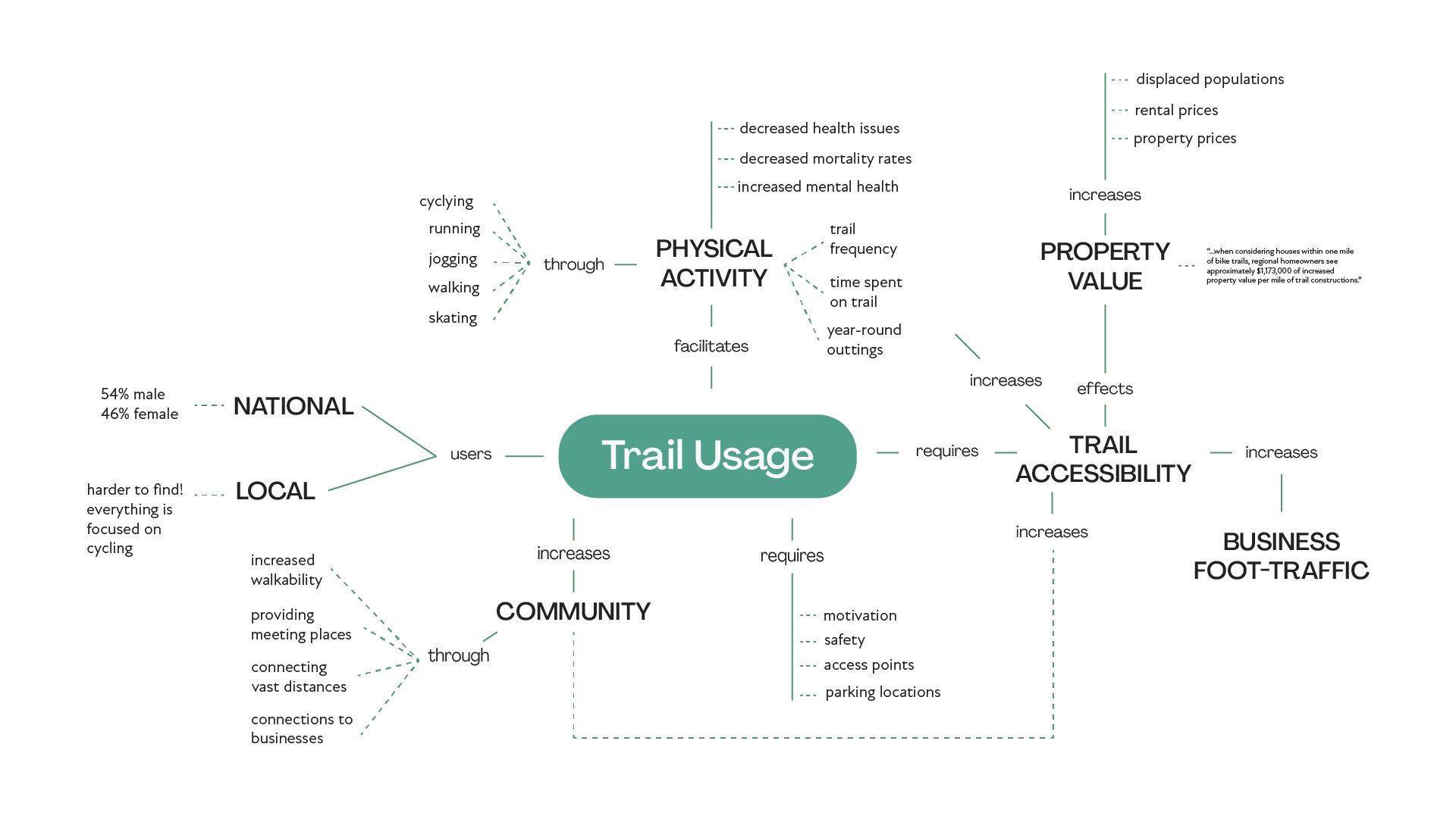
This led me to research greenway and trail projects across the United States. I discovered they all emphasized the benefits to individuals, communities, and states - but with the caveat - only if they were accessible. This led me to examine the northwest Arkansas trail system. I discovered our local trails were inequitable and difficult to access, with few parking spaces, walkable connections, and extremely expensive nearby real-estate.
To understand how the local Queer community used these trail systems, I conducted surveys. While I received few responses (probably due to COVID-19 lockdowns), the data I collected showed that the trail system was not useful for many locals, and Queer users overwhelmingly felt less safe on trail systems than their heterosexual counterparts.
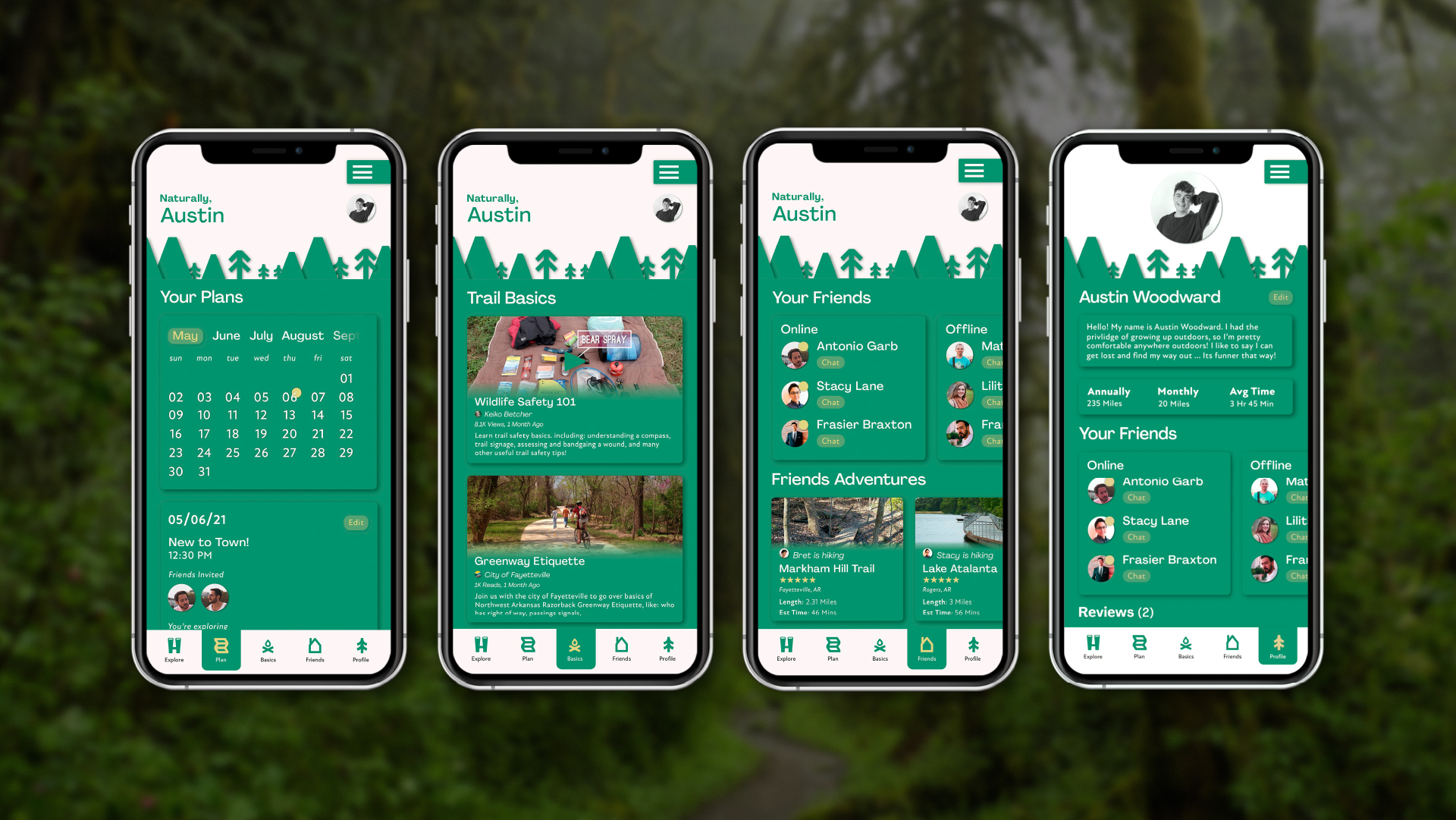
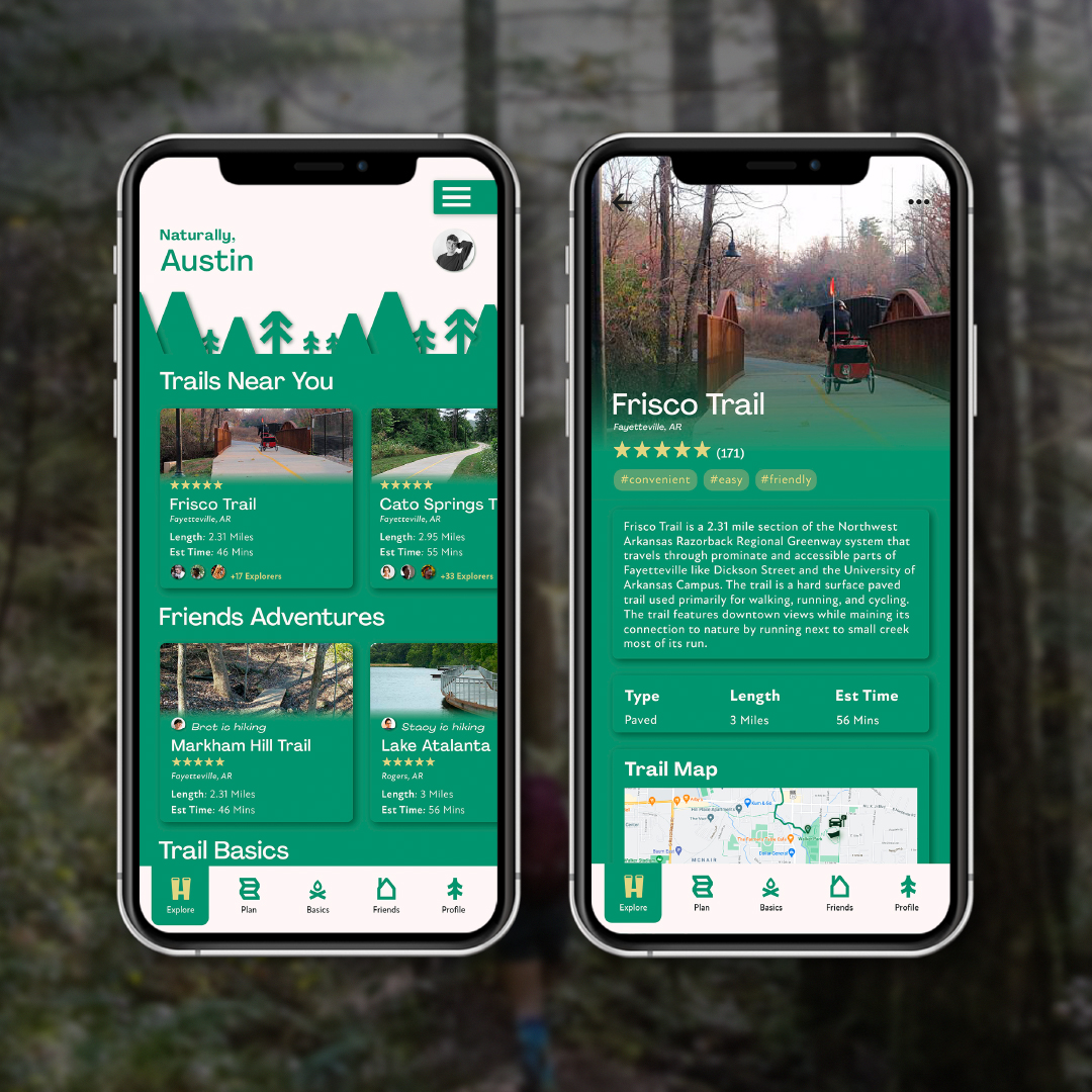
My biggest concern with my capstone project was creating a safer outdoor experience in a space that actively excluded Queer individuals. My solution was a trailhead app called Naturally, a nod to Arkansas being dubbed the natural state. The app displayed critical trail data in a user-friendly format, with a focus on user-generated photography, and extensively mapped every trail and its access points.
Community engagement was key, and every page allowed users to engage with the local Queer community through user-generated photography, view what trails their friends hiked, access open hiking groups, or invite friends to private hiking events. These features, in combination with a section dedicated to outdoor safety practices, aimed to assist Queer community members feel safer and provide multiple opportunities to connect with their community, and access trails on their own terms.
To understand the full breadth of this project, I invite you to view my blog posts outlining parts of my process here, and scroll blow to view my walkthrough of the app. Below you will also find examples of the screens, digital materials created, and some of my creative mind-maps.
![]()
![]()
![]()
![]()
![]()
For my senior capstone project, I know I wanted to share the joy and freedom of the outdoors. I realized quickly that not everyone had access to nature as a child, and I began to wonder if others felt as safe on trails as I did. I was left wondering, how could I help?
This led me to research greenway and trail projects across the United States. I discovered they all emphasized the benefits to individuals, communities, and states - but with the caveat - only if they were accessible. This led me to examine the northwest Arkansas trail system. I discovered our local trails were inequitable and difficult to access, with few parking spaces, walkable connections, and extremely expensive nearby real-estate.
To understand how the local Queer community used these trail systems, I conducted surveys. While I received few responses (probably due to COVID-19 lockdowns), the data I collected showed that the trail system was not useful for many locals, and Queer users overwhelmingly felt less safe on trail systems than their heterosexual counterparts.
My biggest concern with my capstone project was creating a safer outdoor experience in a space that actively excluded Queer individuals. My solution was a trailhead app called Naturally, a nod to Arkansas being dubbed the natural state. The app displayed critical trail data in a user-friendly format, with a focus on user-generated photography, and extensively mapped every trail and its access points.
Community engagement was key, and every page allowed users to engage with the local Queer community through user-generated photography, view what trails their friends hiked, access open hiking groups, or invite friends to private hiking events. These features, in combination with a section dedicated to outdoor safety practices, aimed to assist Queer community members feel safer and provide multiple opportunities to connect with their community, and access trails on their own terms.
To understand the full breadth of this project, I invite you to view my blog posts outlining parts of my process here, and scroll blow to view my walkthrough of the app. Below you will also find examples of the screens, digital materials created, and some of my creative mind-maps.


